Thursday, December 17, 2015

Work week blitz

During a long work week i typically find myself lusting after being outdoors and going on adventures. Typically adventure is reserved for weekends and vacation periods, but what if it didn't have to be that way? I can't take credit for the idea as it is the brainchild of a good friend of mine, Joe Deja, an avid adventurer. Surely others have dreamt up weekday adventures, but i suppose it just never crossed my mind until i read a blog post of Joe's and that's when the proverbial light bulb turned on. Here's how it works; call up a buddy or fellow adventurer and hatch a plan (MTB, fastpacking, canoeing, you name it), rendezvous immediately following your respective workdays, partake in adventure, settle in to camp somewhere for the evening, awake early and go about your regularly scheduled workday. Pretty simple eh?


Awesome singletrack at Owassipe


Chris's first time across the narrow bridge


Making the most of the daylight

My first work week blitz was back in 2012. I got a hold of my buddy Chris and proposed just such a plan; meet up after work at a campsite, head to Owasippe and MTB until dark, return to camp and enjoy a fire/dinner/brews, bivy for the night, wake up early enough to get to work on time. Yeah, i was a little extra tired the next day, but the thrill of adventure during the week kept me going. I feel like the best use of a work week blitz is during a period of time where vacations and far apart, work may be more demanding than usual, and it's just plain hard to get away be it a busy schedule or other priorities. After indulging in this work week extravagance i filed the idea away for another time when it would become necessary. Flash forward to 2015...


Peaceful summers eve at the scout reservation


Ideal end to a work week blitz

It's 2015, the fall is quickly coming to an end after a busy season of MTB and cyclocross racing, and i realize i haven't been out to camp in far too long. Whether we admit it or not, we always tend to categorize our friends into groups; party people, training friends, school friends, and of course, adventure friends! I've had the good fortune over the past year of adding to my group of adventure friends including a one Tyler Keuning. Ideally a work week blitz requires less than an hour of driving to get to the rendezvous destination to maximize adventure time. We elected to meet up at the Diamond Point national forest campground (2 sites) which lies about an hour northwest of Grand Rapids on the White river. I spent some time pouring over the strava route builder, and using the heatmap and strava segments, laid out a route that covered many of the highlights in the area. To add to the adventure i routed us through some forest roads that may or may not be passable.


The route as it was completed 


Nice sunset on the drive up

With hunting season in full swing, Owasippe trails were not an option so a gravel adventure it would have to be. I try to setup routes to favor the wind for the day (face the headwinds early and allow yourself a tailwind for the return), and it would be very important the day of our adventure with gale force winds reported on the lakeshore. We elected to run the route counter-clockwise to give ourselves a nice push on the way back to the cars in the late evening. The route started on some seriously sandy two track terrain, but thanks to recent precipitation it was manageable. We tried our best to stay on forest roads, but none of them wanted to pan out so we opted for paved/maintained gravel north towards the town of Ferry. Thankfully we were both on our Salsa Warbirds with nice 40c rubber mounted to handle the loose stuff. After M20 the roads began to become more desolate and primitive, and we enjoyed a nice grinding climb up high into the hills after which we enjoyed a bombing downhill. There were several false starts as a few of the roads i had chosen dead-ended into private property, so we went rogue and weaved our way west and south back to the next known section on the route. This is where the adventure part of the ride comes from; riding uncharted terrain, roads that may or may not exist anymore in conditions that may or may not allow it.


Pausing for a snack and to collect ourselves


Salsa Warbird, the adventurers weapon of choice!

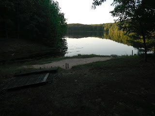
As we slowly plowed our way west directly into the headwind, the nerd in me could only wish that i had my power meter mounted. Between the water logged roads and the brutal gusts there were times when 10 mph seemed a stretch, but nonetheless we grinned and kept our heads down and fought onward. The closer we got to the big lake, the worse the conditions got, but the idea of having a tailwind of 20+ mph kept us grinding away until we crossed the last stretch of road before the lake. I had chosen Whiskey Creek park as a landing zone on the lake to enjoy the wild weather and waves. The sign at the end of the road assured us we had arrived and we eagerly snapped photos and scampered down to the beach to observe nature in one of it's more extreme forms.


Our version of Plymouth rock


Headlight selfie


The path to the lake

The scene at the beach was surreal, with water levels well above normal, the end of the path was as far as we could get. Our stay was short lived as the 30 degree standing temps and howling winds made it unbearable after a time. As we saddled up for the return trip we reveled in the tailwind we had worked so hard to earn. After a short while of heading east we turned south to tackle an ominous section of two track which would have been better handled on a fatbike, but nonetheless we persevered. I was pleased that at least one of the mystery sections had panned out and it would go into the catalog of wicked routes. From there we plodded further south then east onto a seasonal road. If the terrain hadn't begun to freeze we would have been in for a long night as the terrain was reminiscent of the battle fields at DK200 this spring. Surely the tailwind made life better and we approached the next questionable section rapidly; an unsanctioned crossing of US 31. I spent quite a bit of time looking at satellite images to scope a path through the fencing and across the motorway, but nonetheless i was nervous as we approached. It wuld be quite a bummer to have to reroute 3 extra miles to the nearest overpass. On the nearside we had success and quickly bounded into the median where a turnaround simplified things. After awaiting some high velocity traffic to pass we made a run at the farside where only a couple hundred meter separated us from our journey home. Lucky us, some scofflaws had already done away with the fencing that surely would have stopped our progress and with a few quick turns we were back on gravel! We powered our way more rapidly now eastward with an exhilarating crossing behind us and one more good story to tell. The road turned to seasonal status but left two nice tracks for us each to follow until suddenly it didn't...


Tyler fording the creek


Only a headlight shines

The road we had entrusted our salvation with had suddenly turned a blind eye to our progress and then Tyler remarked "hey, this looks familiar, i think i rode this last year on my way home from Silver lake...". I turned inquisitively to him with a do-tell look on my face, and his reply "yeah, there's a creek down there, i waded across it, it was nice in the summer...". What's nice and refreshing in the summer typically doesn't translate to have the same meaning when it's nearly midnight in November. We carefully negotiated the descent to the creek and assessed the situation; not so deep as to be above the waist, not so fast as to get swept away, and obvious entry and exit points. Being my route i took the plunge first and was relieved to only have gotten wet up to my thighs. Tyler followed suit and once again we blazed a path east, now with a bit more moisture. Thankfully that was the last of the adventure for the evening, and as we rolled up to camp the stoke level was high to see we had arrived right at midnight. Tyler had obligations back home so he was unable to camp out, and with the time and weather conditions i elected to try out my first night camping inside the van. The Transit did not disappoint with all of the seats folded i had a nice area to change into wool long johns and socks. I had the radio on low and imbibed in a beverage from Brewery Vivant as i lay there reliving the nights events. As they say, it was a good day.


Right on time


King of the castle!


A hoppy beverage and a happy soul


Tuesday, December 8, 2015

Bikepacking the Manistee National Forest: Part 5

Day three was planned to be the shortest of all to allow for time to travel home, unpack and prep ourselves for returning to reality. Nonetheless, it wasn't a day to write off with some spectacular scenery and views ahead. We packed up shortly after breakfast and headed south then west towards the Pine river via forest roads and a bit of pavement. It was pleasant to start the day out mostly descending towards the river and warming the legs up. When planning a route it's always good to consider the terrain you start and finish each day with. After the river naturally we began climbing back up into higher terrain via frequently used motor vehicle routes. The roads near this area are notoriously sandy and we were pleased to have a fair amount of moisture in the ground to keep the sand packed down.


Saying goodbye to our shelter until the next time!


Awesome forest roads near the Pine river


Enjoying a nice downhill jaunt


ORV bridge on the Pine River

After slogging through some pretty sandy sections we meandered back north a while to stay close to the Pine river and avoid busier sections of road. With the Pine river being a National Scenic area this is a great section to see untainted views and less trammeled terrain. The forest roads we took varied from river lowlands to pine plantations several hundred feet about the river. Every time i cover new terrain is this area it only makes me want to come back and explore more! Before approaching one of my favorite sections in the area we stopped for a short snack break to enjoy some nice hardwood fall colors.


Tyler cruising 


Nice quiet area for a snack break


Seldom used two tracks are the best!

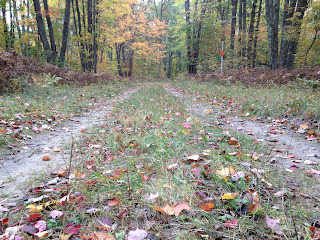
The section of forest road from M37 to Low Bridge on the Pine river is one of my favorite stretches of two track in the area. There are many areas to stop and take in views of the swift Pine below, areas to camp opposite the riverside of the road (camping is not permitted within a set distance of the river as it is a National Scenic section). Although we had the end is sight we found ourselves stopping frequently and slow rolling this section to enjoy the scenery. Even if you don't make it up there for a whole bikepacking trip, this section makes a great day trip ride.


Nice spot for a photo op while searching for an unobstructed view


Beautiful overlook


Hardpacked two-track makes for an easy roll


Even the bikes enjoyed the views

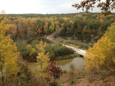
Low Bridge gets its name for an obvious reason, it's really low to the river. In fact, most of the time there is water over the road here so it's a pretty cool area to bomb through in warm temps for a quick cool down. We took more than our share of photos of the area then ventured further south towards the Jerky mecca of Michigan in Dublin. After the hefty climb away from the river the terrain rolls mostly flat to downhill southward to Dublin and to where our journey began. If you haven't stopped at the Dublin General Store and consider yourself to be a carnivore then you're only doing yourself a disservice. Aside from the jerky this is a great lunch stop or resupply point for any trip. After an obligatory stop we quickly covered the last few miles of the journey with some last minute exploration to chart out some new terrain for future trips.


View of Low Bridge from a high bluff


Water on the road


Aptly named river crossing

In summary, our trip covered approximately 155 miles of beautiful terrain. It took about 13 and a half hours of pedaling to cover the ground along with 11,5K feet of elevation. You can find the rest of the nerd data on my Strava account around the time period of Saturday October 10th. Even if you don't have the time/ability/energy/resources to make it out for this long of a trip i highly recommend getting out to explore the area and take advantage of what Michigan has to offer. The best part is that this whole area is totally free to visit, no tickets required or long lines with $4 bottles of mountain dew mocking you in 100 degree heat. Get out and explore!


Tuesday, November 24, 2015

Bikepacking the Manistee National Forest: Part 4

The great thing about laying out under the stars at night is awaking to the sunrise the next day. After a night of heavy dew we needed every bit of warmth we could get to dry things out a bit before packing up and hitting the road. It was a pleasant morning to sit next to the fire and river and enjoying a hot cup of coffee along with some oatmeal laced with fruit and nuts. This day would be very different from the prior day in that we would start out with a few miles of singletrack and that would be it for the rest of the trip. The plan was to head back up the hills and into the countryside north of the river for a bit, utilizing seasonal and secondary roads in a round about way to get to Mesick where we would provision ourselves for the evening and next day.


Rousing ourselves for another day of adventuring!


Tyler cruising the gravel road up to Mesick


All stocked up

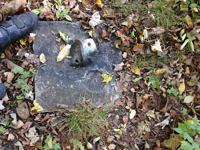
Mesick is a great little town to stock up in mid-ride or even if you're just up to ride the NCT for the day. The Mushroom Bar has tasty burgers, libations and other fried goodies. There's a nice grocery store next door to the bar to provision for any adventure and a few other spots in town for most any need. After departing Mesick we began our trek southeast towards the highest point in the Lower Peninsula dubbed Briar Hill. From Mesick to Briar hill one can expect to gain about 900 feet of elevation in some of the sandiest two tracks around. The "Mesick Mountains" are a popular off-roading area among Jeep enthusiasts and as such the two-tracks can range in conditions. We approached Briar Hill from the northeast and made the long ascent up forest roads to the small parking area at the base of the now closed two track approach. There is a very faint path that winds the remaining distance up to the summit. Very little denots you're on the top save a few footing from and old firetower and a missing USGS marker.


Forest road climb


Firetower footing and missing USGS marker


Resting atop the summit

From Briar Hill we meandered through the national forest roads back towards the tiny town of Yuma for a short snack break before heading back up the ridgeline. The numerous forest roads in this area make for many options on routes and terrain. We chose to follow a route from Yuma to Ridge that i located as a Strava segment figuring that it must be legit since others had ridden it. The route hit some nice sandy areas that our Salsa Beargrease fatbikes tackled with ease, and as we got further up the roads brought us into mature hardwood forests with little undergrowth and stunning views. It felt as though we were riding through a church of sorts and the peacefulness was on par. From the ridge we headed back out to more modern dirt roads and bombed down into the town of Harrieta for a quick breather.


Enjoying the cruise downhill from Briar Hill to Yuma


Helpful signage


Two track cathedral

The road south out of Harrieta may be paved but at 295ft of elevation and 5% grade it knows how to burn a few matches. Loaded down on fatbikes the long climbs require a bit more patience and metering out of power, kind of like piloting a diesel freighter versus a 4 cylinder import. The punishment proved to be worth it with some pleasant views from the Caberfae overlook tower. The paved road was short lived as we departed once again to find more forest roads and rolling terrain. As our route meandered further south and east we began chatting about where to camp and what we wanted camp to be. Both of us agreed it would be preferable to be near a creek or river to wash up in, and we were willing to sacrifice views for that accommodation. On top of needing a refreshing dip we were also in need of a water source as our stores had dwindled rapidly through the tough terrain. Magical things can happen when you're out in the woods on a grand adventure, and i believe the next sequence of events was in that category. Being tired, thirsty and running short on daylight our indecisiveness and lack of a discreet camping location left us in a bit of a dither. Without a firm decision i figured we had best just get some water so we could check that off the list. As we cruised down the county road i spotted a earthen bridge crossing indicating the presence of a water source. Tyler wandered down to the creek with he filter to obtain some fresh drinking water and i followed shortly after a snack to check the creek out. As i was walking down to the creek i spotted a railing in the woods and as i followed it with my eyes i saw what looked like a small cabin. Upon further inspection there was an Adirondack shelter of sorts with a fire pit and old stairs leading down to the creek it appeared we came across a decommissioned campground or access site.


Caberfae lookout


Forest service roads


Water stop


Seemingly inconspicuous creek


Whoa, sweet shelter!

Leaving some things unplanned can turn out to be pretty sweet sometimes, and this case was no exception. Stoke level was high and it was a no brainer to settle down at the shelter for the night. After a quick soak in the creek and collecting a bunch of firewood we settled down for the evening with the creek trickling below and the stars gleaming above. Day 2 was by all accounts a success!


Panoramic view of our digs


Downing some grub by the fire


Sweet view overlooking the creek


Fall colors

Keep your eyes peeled for the final installment of this journey!